

Offline use
The app is built to keep working where hikes actually happen: outside network coverage. Two things can be stored on your device, trails and map regions, and together they cover the full offline experience.
The app detects on its own whether your instance is reachable and switches between online and offline behavior. There is no manual offline mode to turn on.
Download trails
Section titled “Download trails”Tap Download on a trail’s detail page to store it on your device: its route, details, waypoints, photos, and the turn-by-turn directions for navigating it. Downloaded trails are marked throughout the app and can be filtered with the Available offline quick filter.
A downloaded trail alone gives you the route on an empty background. If parts of the trail lie in a map region you haven’t downloaded yet, the app shows a Missing offline map coverage sheet listing those regions with their sizes. Tick the ones you want and tap Download to fetch them together with the trail, or tap Download without ticking anything to store just the trail. Closing the sheet without tapping Download cancels the whole download.
If your instance doesn’t offer a region for the trail’s area at all, the trail is downloaded anyway and a short note tells you that no map is available for part of it.
Download map regions
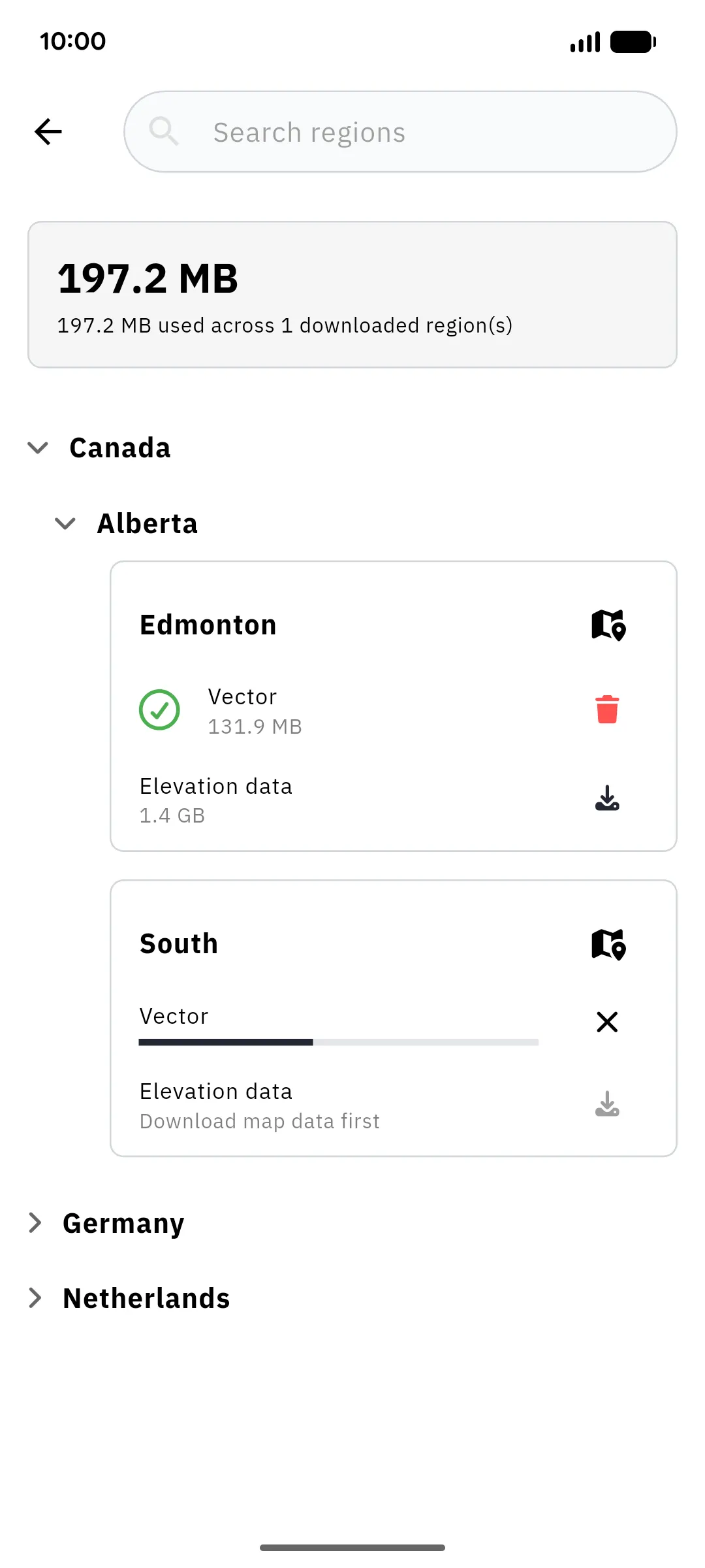
Section titled “Download map regions”You can also manage map regions directly: go to Profile → Settings → Offline Maps/Regions, then search or browse the hierarchy of countries and regions. Which regions are available depends on what your instance’s administrator has enabled; browsing the list needs a connection.
Each region offers two separate downloads:
- Vector: the base map itself (streets, terrain features, labels)
- Elevation data: optional. Adds shaded relief that makes hills and valleys visible, and the data behind elevation profiles. It becomes available once the region’s vector data is downloaded, and is considerably larger.
Both show their size before you start, and a running download can be cancelled at any time. A system notification shows the download progress. The summary at the top tracks the disk space used across all downloaded regions.
Each downloaded row carries its own actions: a trash icon to delete it, and a refresh icon labelled Update available when your instance has rebuilt that region’s map. Deleting a region’s vector data asks for confirmation and also removes its elevation data; deleting the elevation data alone happens immediately.
A region that is greyed out with Not yet available is still being prepared by your instance; check back later. Build failed means the instance ran into a problem preparing it; your administrator can see why.
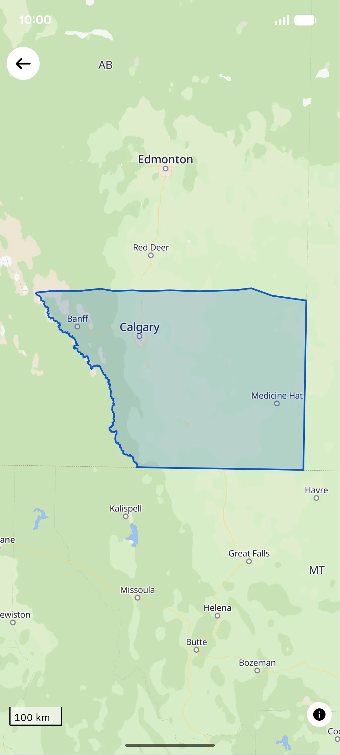
The map icon on a region shows you exactly which area it covers before you commit to the download, useful when a region’s name alone doesn’t tell you whether your hike falls inside it.
The Library
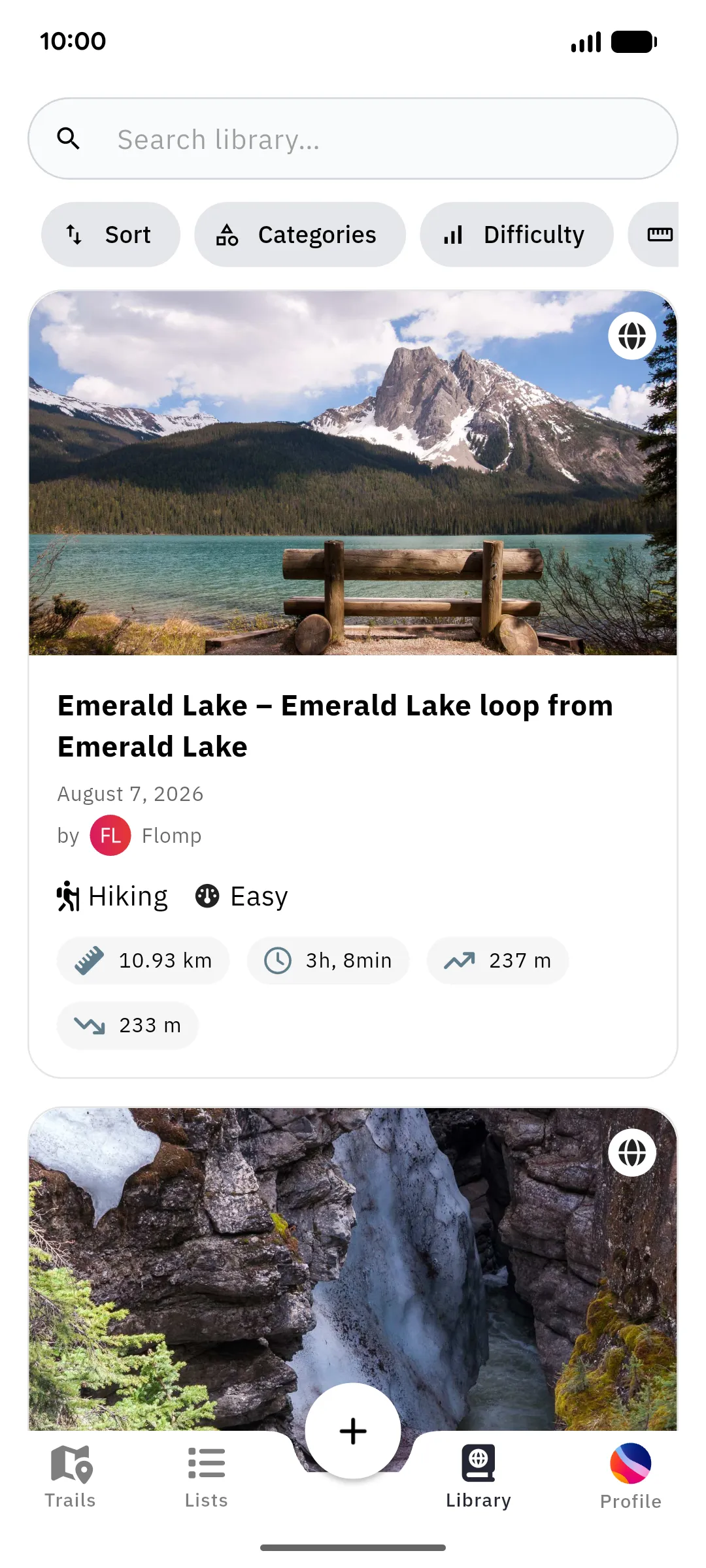
Section titled “The Library”The Library tab lists every trail stored on this device: downloaded trails as well as trails you recorded, imported, or planned that haven’t been uploaded yet. It works fully offline and has its own search, sorting, and filters.
Trails you create offline carry a sync status chip: Waiting to upload while your instance is unreachable, Uploading… while the upload runs, and Upload failed · Tap to retry if an upload didn’t go through. Uploads happen automatically as soon as the instance is reachable again.
What works offline?
Section titled “What works offline?”| Feature | Offline |
|---|---|
| Viewing downloaded trails (incl. waypoints & photos) | ✅ |
| Comments and summit logs | ❌ need a connection, even on downloaded trails |
| Base map & shaded relief in downloaded regions | ✅ |
| Recording a trail | ✅ (uploads later; the Follow roads / Recalculate heights options are skipped) |
| Importing a file | ✅ GPX only; other formats need a connection |
| Navigating a downloaded trail | ✅ |
| Browsing/searching your instance’s trails | ❌ needs a connection; the map shows only downloaded trails |
| Liking a trail | ❌ needs a connection |
| Editing or deleting a trail that is already on your instance | ❌ needs a connection |
| Route planning | ❌ needs a connection (routing runs on the instance) |
| Lists, other users’ profiles, following | ❌ needs a connection |
| Browsing the region catalogue | ❌ needs a connection (already downloaded regions keep working) |
| Settings | read-only until you reconnect |